Search This Blog

Showing posts with label smoke. Show all posts

Saturday, August 13, 2011

FIRE & SMOKE plenty of both!

Last week every one of our regions saw some wildfire activity, thankfully these fires have been quickly suppressed by the efforts of the local fire departments and the Virginia Department of Forestry. By Virginia code the Department of Forestry is the responsible agency for the suppression and management of all wildfires on non-federal lands HOWEVER the VDOF can NOT do this alone and it is because of the collaboration and efforts of the volunteer and paid fire departments all accros the Commonwealth that we all can be proud of our records.

Yesterday Nationally there were 149 new large (over 100 acres) fires 37 of them being in the South.

The following will provide an update on the Lateral West Fire in the Great Dismal Swamp and the wildfires in TX, which continues to deal with the drought and wildfires.

There is fire, actual flames, on this fire and plenty of them. But the big story is the smoke right now. The flames may be having a direct impact on the firefighters, the vegetation and the wildlife within the 110,000 acre swamp but the smoke is impacting hundreds of thousands of people.


And there is PLENTY of SMOKE! There are reports of smoke impacting the public up to 150 miles away.


The following was taken from a story online from the Daily Press

10:53 p.m. EDT, August 12, 2011

 Here's a more detailed look at the fire, its effects, and why it's burning faster than a similar blaze in 2008:

The fire's size
At roughly 5,585 acres, the fire Friday covered an area slightly larger than the city of Williamsburg.

While it's the refuge's largest ever, it's much smaller than wildfires further south and west. For example, more than 300,000 acres are burning at Okefenokee National Wildlife Refuge in Georgia. Also, nearly 17,000 fires have scorched more than 3.4 million acres in Texas this summer. MORE ON THE TX FIRES LATER

Quick-burning
It took about one month for the 2008 Dismal Swamp wildfire to burn 4,884 acres, said Catherine Hibbard, a U.S. Fish and Wildlife Service spokeswoman. The current fire, which covers much of same area, burned 5,000 acres in a week.

In addition to hot and dry conditions, the current fire is fueled by large amounts of dead and downed trees — remnants of Hurricane Isabel in 2003 and the 2008 fire. There are also plenty of grass, brush and peat — decomposing vegetation that can accumulate up to three feet thick, Hibbard said.
"You have the perfect conditions," she said.

Effect on humans
Smoke from wildfires contains particulate matter, which are tiny airborne particles that make it difficult for people with respiratory ailments to breathe.

Communities in Suffolk, Isle of Wight County and further west along Route 460 may be placed under a Code Purple conditions Saturday, state Department of Environmental Quality meteorologists said. Under such a scenario, the air is considered very unhealthy and people are advised to avoid outdoor activity.

Winds are expected to shift Monday with smoke blanketing much of Hampton Roads again, the DEQ said.

 For more please refer to the full story at the link below.... 

Great Dismal Swamp fire sets records

The blaze scorched 5,585 acres, an area slightly larger than Williamsburg, Va.


And now for an updat on the TX fires ....


Texas Fires 2011 Fact Sheet
(All figures are from 15 Nov. 2010 to 12 August 2011, unless noted.)
Days on incident: 269
Personnel currently on incident: 1,079
States that have sent firefighters or other personnel:
48 plus District of Columbia, Puerto Rico and U.S. Virgin Islands
Total fires in Texas since Nov. 15, 2010: 18,068
Total acres burned in Texas since Nov. 15, 2010: 3,430,734
(exceeds previous record of 2,105,361 acres set in 2005-2006)
Fires in Texas in 2011: 16,062
Fires nationally in 2011: 47,502
Proportion of total national fires in 2011 that have occurred in Texas: 33.8 percent
Acres burned in Texas in 2011: 3,367,880
Acres burned nationally in 2011: 6,332,554
Proportion of total national acres that have burned in Texas: 53 percent
Ten-year U.S. national average acres burned: 4,771,423 acres/year
Four of the 10 largest wildfires in Texas history occurred in April 2011.
Total Aviation Hours: 11,220
Total aviation drops: 32,601
Gallons of fire retardant dropped: 4,208,846
Gallons of water dropped: 16,316,547
Did you know that if you added up all the water and retardant dropped it would fill about 35 Olympic sized swimming pools!
Most flight hours recorded in a single day: 238.39 (20 June 2011)
Most gallons of water and retardant dropped in a single day: 792,393 (20 June 2011)
(Note: All air operation figures are from 21 Dec. 2010, when record-keeping began.)
Texas counties where Texas Forest Service has fought wildfires: 192 of 254
Homes and structures saved: 34,666
Homes saved: 23,438
Homes and structures lost: 2,481
Homes lost: 625
Texas counties with burn bans: 249 of 254
(Exceeds previous record of 221 set in 2006)


Thursday, August 11, 2011

The Swamp Fire smokes on and Smokey's special week comes to an end

The news from the Lateral West / Dismal Swamp Fire is that its getting bigger, by today sometime it will eclipse the 5,000 acre 2008 South One Wildfire which was the swamps biggest and most costly ($11,000,000.00+) fire in history. Early estimates are that it will get really big, big for VA/NC standards 10,000 ac + Its pushing south now with a lot of swamp in front of it.
Check out this pix from this morning.

1950 Smokey


1951 Smokey.
 The 1st frendly Smokey costume, the one that provided a pattern for all future costume development. (Sorry Wissconson!)


A few images from the very first (?) Smokey comic.


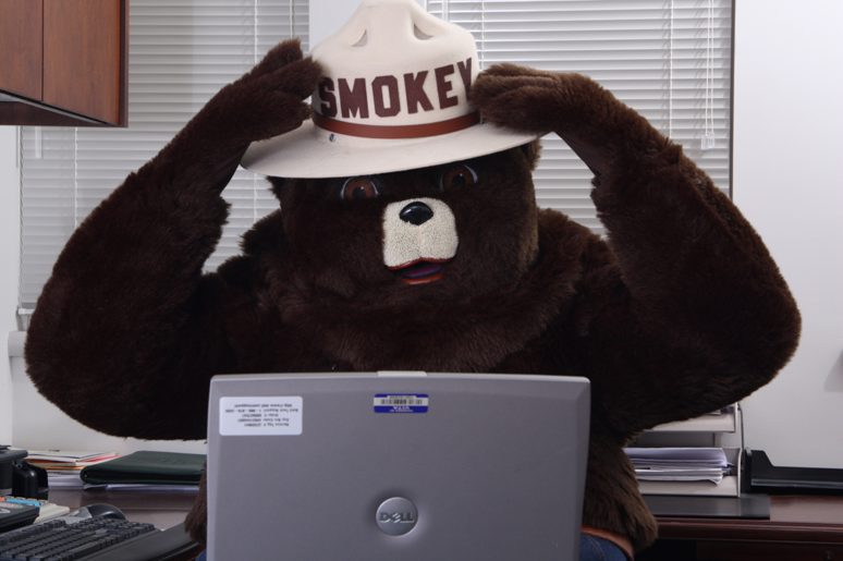
Smokey has a hard time grasping all this new technology.

This is a new sticker I am working on with my Virginia friends. Hope you'll like it.

Well I sure enjoyed this special week and a brief look back and I hope you did as well.
PLEASE help me by doing your part to NOT let a Wildfire Start. The firefighters have their hands full with the ones mother nature is causing.

THANKS for a great 67 years and I'm looking forward to many more!


Wednesday, August 10, 2011

Dismal Swamp Update

The following was received from the Information Officer from the fire.

For Immediate Release                                               Information Officer August 10, 2011                                                                       757- 986-3705 ext. 26
8:30 a.m.
FIREFIGHTING FORCE GROWS AT WILDFIRE
IN THE GREAT DISMAL SWAMP NATIONAL WILDLIFE REFUGE

Nearly 100 firefighters are on the ground and in the air fighting the Lateral West Fire in the Great Dismal Swamp National Wildlife Refuge.  Since Friday morning, the numbers of people and amount of equipment has increased every day.   Fire professionals are on foot with hand tools, aboard heavy equipment and flying helicopters working to suppress the wildfire.  The interagency Southern Area Incident Management Blue Team is now working for the refuge managing the fire.  As of 4:00 p.m. yesterday the fire was estimated to be 3,200 acres. The fire is southwest of Lake Drummond off Interior Ditch Road. This morning the fire crossed into the Dismal Swamp State Park in North Carolina.
For firefighter and public safety, the following closures are in place until further notice.  Lake Drummond is closed to boating.  Railroad Ditch Road is closed to all public use activities including scheduled tours. The Lake Drummond Reservation and boat trolley, located between Lake Drummond and the Dismal Swamp Canal, are closed.
The Dismal Swamp State Park in North Carolina is closed until further notice.
Firefighters continue to work at constructing and reinforcing fire breaks.  Additional people and equipment are en route.  The information officer can be reached at 757-986-3705 ext. 26.
The Lateral West Fire was started by a several day-old lightning strike in the refuge interior.  The fire was reported to the refuge at 7:00 p.m. on Thursday, August 4, 2011. 

                                                                                    ###

The Great Dismal Swamp Fire "Again" We need a rain with a name!

I sure hope you enjoyed my birthday yesterday. Many firefighters could not enjoy the day as they were fighting fire, protecting people, homes and natural resources.
This morning I am going to focus on wildfire activity in Va, might post some more historical stuff later if I have time.
As we talked about a few blogs ago its getting dry, really dry in several places and the Southwest, Northern Valley and the Southeast are at the centers of the drought. The Great Dismal swamp is burning again. It was 2008 when a 5000 acre fire burned for several weeks and cost over $11,000,000.00 to suppress. And they are expecting this one to go bigger.

What we need is a RAIN WITH A NAME !!

I will be providing some info on the fire including a few pictures taken from the WAVY TV site, but first a bit of a Dismal Swamp History lesson. This is a wonderful place, one where fire plays a big role in its development, growth and health. BUT thats fire in the right place at the right time not an unplanned wildfire. So please enjoy this info and keep on reading to get info about the fire.


The Great Dismal Swamp History Lesson

The Great Dismal Swamp is a marshy area between Norfolk, Virginia and Elizabeth City, North Carolina. It is a southern swamp like many along the Atlantic Ocean’s coast which include the Everglades, Big Cypress Swamp and Okefenokee Swamp.  Essential to the swamp ecosystem are its water resources, native vegetation and varied wildlife. The Great Dismal Swamp's ecological significance and its wealth of history and lore make it extremely unique. It is one of the last large and wild areas remaining in the Eastern United States.

After centuries of logging and other activities which were devastating the swamp's ecosystems, the Great Dismal Swamp National Wildlife Refuge was officially established by the US Congress through The Dismal Swamp Act of 1974. The refuge consists of over 111,000 acres of forested wetlands. Lake Drummond, a 3,100 acre natural lake, is located in the heart of the swamp. Outside the boundaries of the National Refuge, the state of North Carolina has preserved and protected additional portions of the swamp, as the Great Dismal Swamp State Nature Area. The whole swamp has a peat bog lying just under the surface.

There is archaeological evidence which indicates human occupation began nearly 13,000 years ago. Some scientists believe the Great Dismal Swamp was created when the Continental Shelf made its last big shift. The origin of Lake Drummond, one of only two natural lakes in Virginia, is disputed.
Other scientists believe the lake could have been created by the impact of a meteoroid because it is oval shaped. They think it was made by a big meteoroid like the ones that are thought to have made the Carolina Bays. Other people believe it was made by a large underground peat burn about 3,500 to 6,000 years ago. Indian legend talks about "the fire bird" creating Lake Drummond.

By 1650, few American Indians remained in the area and European settlers showed little interest in the swamp. In 1665, William Drummond, a future governor of North Carolina, was the first European to explore the lake which now bears his name. A surveying party entered the swamp to draw a dividing line between Virginia and North Carolina in 1728.

 George Washington visited the swamp and then formed the Dismal Swamp Land Company in 1763, which proceeded to drain and harvest timber from part of the area. A five-mile ditch on the west side of the current refuge there still bears his name. In 1805, the Dismal Swamp Canal began serving as a commercial waterway for timber from the swamp.

Painting: Fugitive Slaves in the Dismal Swamp, Virginia by David Edward Cronin 1888

Before and during the Civil War, the Great Dismal Swamp was a hideout for runaway slaves. Some people believe there were at least a thousand slaves living in the swamp at one time. This was the subject of Dred: A Tale of the Great Dismal Swamp, Harriet Beecher Stowe's follow-on to Uncle Tom’s Cabin.
While all efforts to drain the swamp ultimately failed, logging of the swamp proved to be a successful commercial activity. Regular logging operations continued as late as 1976. The entire swamp has been logged at least once, and many areas have been burned by periodic wildfires. The Great Dismal Swamp has been drastically altered by humanity over the past two centuries. Agricultural, commercial, and residential development destroyed much of the swamp, so that the remaining portion within and around the refuge represents less than half of the original size of the swamp. A drier swamp and the suppression of wildfires, which once cleared the land for seed germination, created ecological conditions that were less favorable to the survival of cypress stands. As a result, plant and animal variety decreased.


The primary purpose of the refuge's resource management programs is to restore and maintain the natural biological diversity that existed prior to the human-caused alterations. Water is being conserved and managed by placing water control structures in the ditches. Plant community diversity is being restored and maintained through forest management activities which simulate the ecological effects of wildfires. Wildlife is managed by insuring the presence of required habitats, with hunting used to balance some wildlife populations with available food supplies. Many species including black bear, bobcat, otter, and weasel, along with over 70 species of reptiles and amphibians call the swamp home. More than 200 bird species can also be seen at the swamp throughout the year. 

In the mid 20th century, conservation groups from all over America began demanding that something be done to preserve what was left of the Great Dismal Swamp. In 1973, the Union Camp Corporation, a paper company which had had large land property in the area since the beginning of the 20th century, donated just over 49,000 acres of its land to The Nature Conservancy which transferred the property the following year to the US Fish and Wildlife Service.


OK now that our history lesson is over lets talk about the current fire.


The Lateral West Fire in the Great Dismal Swamp National Wildlife Refuge was started by a several day old lightning strike in the refuge interior. The fire was reported to the refuge on the evening of August 4, 2011. Drought conditions throughout the area have dried the deep organic soils, brush and downed dead trees. These fuels will continue to burn until there is at least six inches of rain over a period of a few days.
The Great Dismal Swamp is southeast of Suffolk, Virginia. It is burning in the fire scar of the 2008 South One Wildfire. Dense smoke will likely be a public health and safety concern for the foreseeable future. Several closures are in place.
Basic Information
Cause - Lightning
Date of Origin - Thursday August 04th, 2011 approx. 07:00 PM
Size- 2,500 acres    
Fuels Involved - Regrowth of brush and grass and downed dead trees from 2008 South One Fire. Pine pocosin, deep organic soils.
Percent Contained - 10%
Fire Behavior - Fire showed steady rates of spread, with 4-5 foot flame lengths on backing fire, with flare-ups of 10-12 feet. Head fire was twice those values, with short range spotting. Large plume of smoke maintained throughout by intense burning of organic soils and dead and down fuels.

Significant Events - Planned prep work on Riddick Ditch abandoned because of fire spread to the east. Prep work on Interior Ditch proceeded as planned. Members of the Southern Area Incident Management Team are arriving.


Several other wildfire occured yesterday or in the last few days. James City County had a significant fire late yesterday.

There is not alot we can do about the lightning caused wildfires BUT we can do our part and not let a wildfire start because of our carelessness. There are also things you can do to help protect your home from wildfire PLEASE visit http://www.firewisevirginia.org/ for more info.

Growth Potential - High